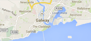
The Communities

Each community in the 3-cities Project was selected through consultation with a variety of city residents and community stakeholder in each of the three cities.    This selection process was based   on criteria which are outlined below.

  1. Socio-economic status: Socially deprived/disadvantaged, middle-class or affluent areas.

  2. New urban/suburban developments

  3. New communities: e.g. ethnic and migrant communities

  4. Significant population and community change: Population churn, processes of gentrification

  5. Inner-city locations


Galway

Doughiska, Galway

Doughiska

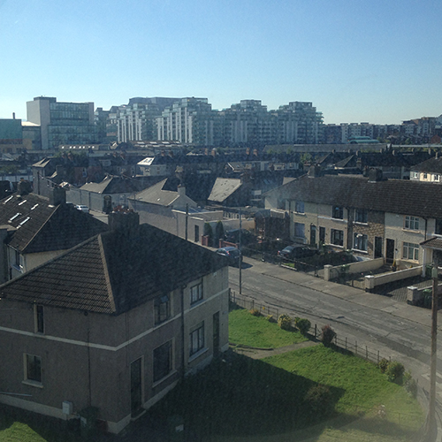
Doughiska is a newly-built, developing and exceptionally diverse neighbourhood in the outer suburbs of Galway city. This neighbourhood is located as one locale within the greater Roscam, Ardaun and Doughiska (ARD) community structure.  Doughiska is involved in a process (led by community stakeholders) that sets out to integrate and build capacity across Ardaun, Roscam and Doughiska as one broader community context. Doughiska's urban landscape has rapidly changed over the last 10 years, with houses and recreational amenities replacing the once green fields.  Much of this transition has been driven by urban pressures related to demographic and economic growth which has seen a high influx of people moving to Doughiska.  Doughiska has nearly 50% non-Irish residents, making the community rich in a variety of cultures and traditions. This diversity is at the heart of the community, with every effort being made to make the community as inclusive and cohesive as possible.  Change brings about its own challenges.  These can be investigated through people’s experiences of the community.


Claddagh, Galway

Claddagh

Claddagh is an established small community nestled in the heart of Galway City.  The name Claddagh originates from the Irish word ‘Cladach’ meaning stony shore.  Its location across from the iconic Spanish Arch, as the river Corrib meets the bay, is like no other community in Galway.  Formerly a small fishing village that lay outside the city walls, Claddagh has its own King and was traditionally Gaelic speaking.  The Claddagh as a community is going through a period of considerable change.  Although the urban landscape has remained the same in recent times the original thatch cottages that once populated the area in the early 1900s are long gone. The proximity to the city and the scenic landscape that surrounds the community, makes Claddagh a much sought after place to live, with younger and more affluent families having moved into the neighbourhood in recent years. This means that the Claddagh consists of both an ageing long-time resident population, and various groups of new comer residents.  Despite all these changes Claddagh remains a unique community that harbours strong historical links to cultural and economic traditions based on Galway bay. Its strong sense of place and connection to the sea acts as a fulcrum in the community that draws people to the area. Community change can pose challenges and some of these are explored in the research. 


Limerick

Garryowen, Limerick

Garryowen

Garryowen is an established community, located on the southern outskirts of Limerick city. Garryowen community members are comprised of some second and third generation families in the area.  The historical roots of Garryowen centred on local industry such as basket making, lace production and breweries. These traits remain a source of pride in the area to date, although little advancement has been made since the cessation of these industries. In recent years the area has seen demographic change; experiencing regeneration which has altered the sense of community. Despite the changes and challenges faced by the community, Garryowen maintains a strong sense of community pride.


Limerick

South Circular Road

The South Circular Road area is an established community on the south side of Limerick city with a mix of resident types, including older Edwardian housing as well as more recent terraced and semi-detached houses, and newer apartment blocks. Although the area has been residential for most of its history, with many older residents having lived there their entire lives, it has experienced some de population as people move out to the outskirts of the city. The area is currently home to secondary and third-level educational institutions—notably Laurel Hill and St Clements secondary schools and Mary Immaculate College—with an expanding student population, and a direct-provision centre for migrants. There is consequently a large presence of temporary residents in privately-rented accommodation and a seasonally fluctuating population. South Circular Road itself remains a sought-after residential location, though, due to the schools, the teacher-training college and the area’s proximity to the city centre. However, the built environment took shape in a time when fewer cars or people were accessing the area, which has resulted in mounting issues for commuters and residents alike.


Dublin

The Liberties, Francis Street

The Liberties

The Liberties is a historical neighbourhood in Dublin with a strong collective sense of place. This sense of place is reinforced by long established traditions and heritage which has been passed on from generation to generation of people living in this area. The Liberties community heritage is to a degree born from historical experiences of poverty and hardship. Manifestations of these can be identified in the urban fabric of the area. The Liberties has for example one of the highest percentage of children living in social housing in Ireland.However this is also an area marked by change.  Much of this transition has been driven by urban pressures related to demographic and economic growth which has seen a high influx of people coming into the Liberties.  The day to day life of people living in this area is marked by these very different factors. In many ways and despite of strong traditions, community interactions in this neighbourhood are in transition. Understanding the implications of these changes is crucial for future service provision in the area.


East Wall, Saint Mary's Road

East Wall

East Wall as a dockland community of Dublin bears many similarities with adjoining communities which also have traditions association with the dockland area. Their historical links to cultural and economic traditions based on the docks has created a very specific sense of place which many local people liken to village living rather than inner city neighbourhood living.  East Wall like the other docklands communities has experienced considerable change in the last thirty years. Decline of port activities and the subsequent redevelopment of the area directed at finance and third sector services and infrastructure has had an impact on the urban and demographic composition of the area. Initial declining and ageing population patterns have in recent years reversed into a trend which has seen younger and more affluent families moving into the area. All of these factors have change the structure of existing communities in the area and led to a degree of social polarisation.  Despite these greater trends, East Wall remains a unique neighbourhood. In the face of these challenges East Wall is still a very close knit community. This is reinforced by the strong sense of place and belonging that people in the area display in relation to East Wall.