-
Courses

Courses
Choosing a course is one of the most important decisions you'll ever make! View our courses and see what our students and lecturers have to say about the courses you are interested in at the links below.
-
University Life
University Life
Each year more than 4,000 choose University of Galway as their University of choice. Find out what life at University of Galway is all about here.
-
About University of Galway
About University of Galway
Since 1845, University of Galway has been sharing the highest quality teaching and research with Ireland and the world. Find out what makes our University so special – from our distinguished history to the latest news and campus developments.
-
Colleges & Schools
Colleges & Schools
University of Galway has earned international recognition as a research-led university with a commitment to top quality teaching across a range of key areas of expertise.
-
Research & Innovation
Research & Innovation
University of Galway’s vibrant research community take on some of the most pressing challenges of our times.
-
Business & Industry
Guiding Breakthrough Research at University of Galway
We explore and facilitate commercial opportunities for the research community at University of Galway, as well as facilitating industry partnership.
-
Alumni & Friends
Alumni & Friends
There are 128,000 University of Galway alumni worldwide. Stay connected to your alumni community! Join our social networks and update your details online.
-
Community Engagement
Community Engagement
At University of Galway, we believe that the best learning takes place when you apply what you learn in a real world context. That's why many of our courses include work placements or community projects.


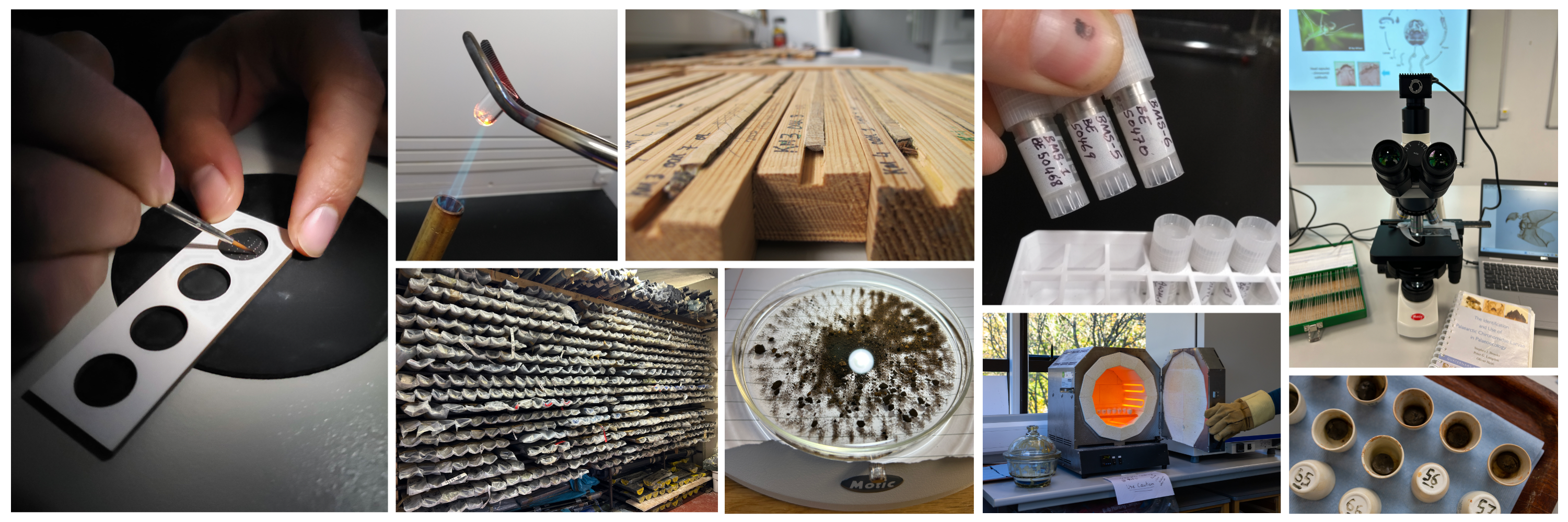
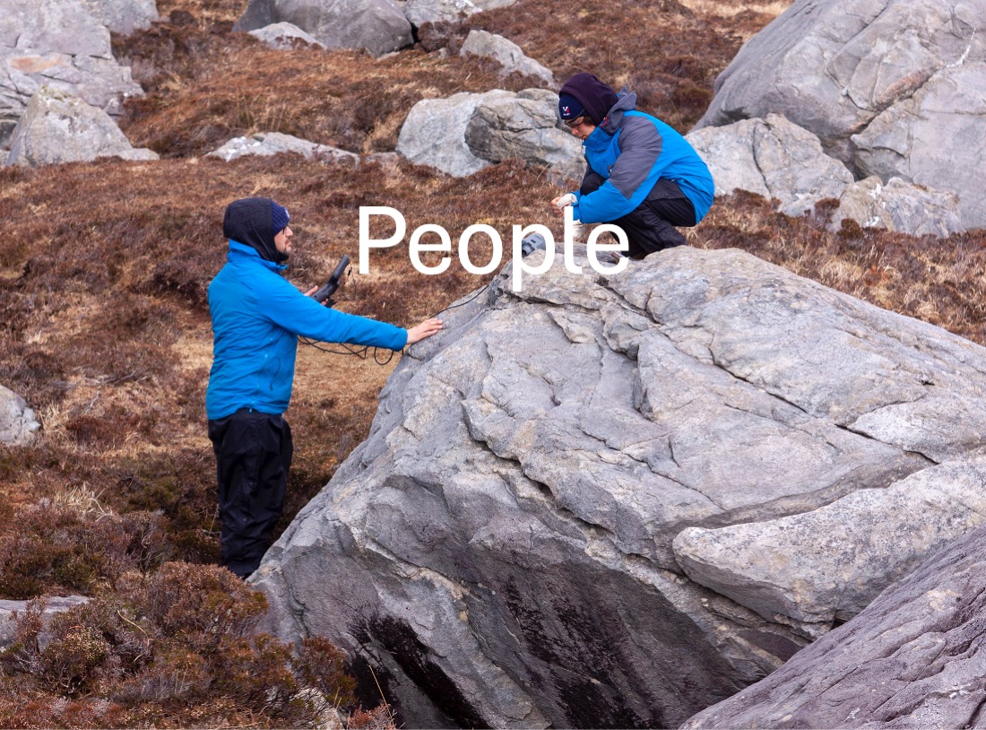
Projects
Click on the project titles below to learn more....
A cosmogenic-nuclide approach to quantifying the drivers of rocky coastline erosion under changing climate and sea-level conditions
Project title: A cosmogenic-nuclide approach to quantifying the drivers of rocky coastline erosion under changing climate and sea-level conditions
Brief: Ireland’s hard-rock coastlines are innately vulnerable to changes in sea level and/or maritime climate. This project applies a coupled modelling-cosmogenic nuclide approach to establish the long-term drivers of rocky coastal erosion in Ireland.
Funder: Science Foundation Ireland Research Centre in Applied Geosciences (SFI iCRAG)
Project team:
- Dr Gordon Bromley (PI)
- Gregor Rink (PhD student)
Abstract: Ireland is defined physically and culturally by its coastline, which underlies much of our industrial, agricultural, residential, and tourism sectors. In view of accelerating sea-level rise and increasing storminess, the Irish coastline also constitutes the dynamic frontline of erosion and mass wasting in the 21st Century and beyond. Projecting how coastal stability will respond to these physical agents, and quantifying the risk of loss due to retreat, is thus a priority for adaptation strategies and stakeholders alike. Focusing specifically on rocky coasts, the objectives of this two-phase programme are to (1) constrain the long-term evolution of rocky coastlines, (2) establish the drivers of coastal erosion and stability, and (3) simulate future coastal change under shifting climate/environmental conditions. Rocky coastlines comprise the majority of Ireland’s perimeter, yet there is little information on their evolution and sensitivity. Acknowledging Ireland’s vulnerability to climate change and the North Atlantic Ocean, this project is highly timely and central to effective adaptation/mitigation strategies. Anticipated outcomes of Phase 1 include quantitative records of long-term coastal retreat in multiple sectors, constrained with cosmogenic-nuclide geochronology, identification of the relative importance of sea level and storminess on coastal stability, and development of a roadmap for predictive modelling of future coastal change.
Aims and objectives:
- Generate precise records of long-term rocky coastline development, constrained with cosmogenic 10Be dating, for three pilot sites along Ireland’s Atlantic seaboard: Belderrig (Mayo), Bundoran (Donegal), Kilkee (Clare)).
- Compile records of recent (~150 years) coastline change from topographic maps, aerial photography, and remote sensing.
- Incorporate reconstructed histories into ‘maximum likelihood estimation’ (MLE) modelling to assess specific erosional scenarios.
- Establish from these records whether Ireland’s rocky coastlines reflect rapid and ongoing formation during modern interglacial conditions, inheritance over longer timescales (tens-hundreds of millennia), or a combination of the two.
![]()
A multi-proxy geology approach to resolving critical uncertainties in Irish cosmogenic nuclide geochronology
Project title: A multi-proxy geology approach to resolving critical uncertainties in Irish cosmogenic nuclide geochronology
Brief: Cosmogenic nuclide surface-exposure dating is a key tool in geomorphology and Quaternary palaeoclimatology. This project seeks to refine our understanding of nuclide production rates in the northern middle latitudes (Ireland specifically) and how any temporal variability might impact age calculations.
Funder: Geological Survey Ireland (GSI)
Project team:
- Gordon Bromley (PI)
- Colin Bunce (Research Assistant)
- Brenda Hall (Project Partner)
- Nick Scroxton (Project Partner)
- Frank McDermott (Project Partner)
Abstract: Anthropogenic climate change is the defining socio-economic force of the 21st Century, posing a direct threat to economic vitality, human well-being, and environmental integrity in Ireland and globally. Principal challenges include (1) minimising knowledge gaps surrounding climate’s capacity for rapid shifts, thereby boosting our ability to predict future change, and (2) improving our understanding of climate’s role in landscape evolution, which is fundamental to geohazard risk assessment under warming conditions. Concurrently, novel technologies are key to accessing the resources to fuel Ireland’s transition to a low-carbon economy. These challenges draw heavily from geoscience, in which cosmogenic nuclide geochronology plays an increasingly vital role.
Despite its growing reputation, the efficacy of the cosmogenic toolset is undercut by persistent uncertainty surrounding nuclide production rates, particularly at boreal mid latitudes (i.e., Ireland). Employing a coupled geologic–geochemical (U-Th/14C/10Be) approach, we will [1] quantify the beryllium-10 production rate in Ireland, [2] establish whether this rate has fluctuated temporally (e.g., due to geomagnetic variability), and [3] appraise how well current scaling models account for these fluctuations. Reflecting the diverse application of cosmogenic nuclides, this work impacts the fields of palaeo-/climatology, coastal vulnerability/geohazards, sediment tracing, and rare-earth element prospecting, with ramifications for archaeologic and geoheritage interests.
Aims and objectives:
- Identify quartz-bearing calibration landforms/surfaces for which independent age control exists or is feasible.
- Provide independent age control for calibration surfaces via U-Th dating (of speleothems), 14C dating (of glacial moraines and lacustrine stratigraphy), or both.
- Measure 10Be in the same surfaces.
- Deliver local, Irish production rates and evaluate the efficacy of existing scaling models to satisfy these chronological targets. Complementing the science, further objectives include delivering project findings to the geoscience community and a broad public audience.
Assessing topographic impacts on tropical glacier extent and moraine formation
Project title: Assessing topographic impacts on tropical glacier extent and moraine formation
Brief: The viability of glaciers as terrestrial climate proxies depends on quantifying the additional roles of topography and hypsometry on glacier behaviour and moraine formation. This project applies glacier modelling and field-based reconstruction of tropical glaciers to constrain the topographic influence on glacier flow.
Funder: National Science Foundation (GDL)
Project team:
- Meredith Kelly (PI)
- Alice Doughty (co-PI)
- Gordon Bromley (Project Partner)
- Sergio Restrepo (Project Partner)
- Daniel Ruiz (Project Partner)
- Jordan Herbert (PhD student)
- Peter Galloway (PhD student)
Abstract: Many mountain glaciers are currently retreating as a result of climate change, and decades of research have used past glacial fluctuations (advances and retreats) to understand the mechanisms of past climate change. Yet, mountain glaciers are also influenced by underlying topography. We examine the influence of topography on glacial extents via computer modelling and reconstructions of past glacial extents in Uganda and Colombia. The small footprint of these tropical ranges makes it likely that neighbouring valleys experience similar climatology and, thus, any differences in glacial extents should be due to topographic differences. Moreover, Uganda and Colombia are among the few tropical locations where long-term records of glacial changes in multiple adjacent valleys may be obtained. The project will improve the ability to forecast future glacial changes and model landscape evolution. It will also advance the use of past glacial extents to understand the causes of past climate changes.
The project will use glacial modelling in combination with modern climate data and surface exposure dating of glacial moraines (ridges that mark former glacial extents) to assess topographic impacts on tropical glacial extents and moraine formation. Our focus is the Sierra Nevada del Cocuy (Colombia) and Rwenzori Mountains (Uganda). The project provides one of the few datasets available to examine the relative impacts of climate and topography on glacial extents and, thus, advance the ability to model the response of glaciers to future climate changes. It also improves the ability to infer past climate conditions from the geomorphic record of glacial extents.
Aims and objectives:
- Assess how variations in specific topographic characteristics influence glacial extents using glacial modelling with idealized digital elevation models.
- Assess how variations in topography influenced past glacial extents in two tropical mountain ranges using glacial modelling and surface exposure dating of moraines.
![]()
Constraining the Impact of Ocean Acidification on Arctic Foraminifera (iCRAG 2)
Project title: Constraining the Impact of Ocean Acidification on Arctic Foraminifera (iCRAG 2)
Funder: Science Foundation Ireland Research Centre in Applied Geosciences (iCrag)
Project team:
- Dr Audrey Morley (PI)
- Dr Thomas Weiss (Postdoctoral researcher)
Abstract: In this project, we pioneer a conceptually unique dual approach to identify the distinct microstructural and geochemical processes of dissolution that alter the original signal of essential climate variables or ECVs (e.g., temperature, salinity, pH) recorded in Neogloboquadrina pachyderma (NP) shells. Specifically, we will combine novel techniques in microCT scanning and interpretative frameworks developed in biomedical engineering with traditional geochemical tracers of ECVs to statistically determine the signal contribution of explanatory variables (e.g., ECVs, dissolution, diagenesis) to geochemical response variables (e.g., Mg/Ca, δ11B, δ18O) using a predictive generalized linear model (GLM). Combining biogeochemical techniques and innovative microstructural analyses on NP will allow us to quantify physiochemical processes, that influence how geochemical tracers are recorded, at the time of proxy development. This approach will advance our understanding of Arctic climate and thereby provide the critical basis for testing future hypotheses, inside and outside of the Arctic, related to mechanisms controlling climate tipping points globally in the past, present, and future.
This project brings together researchers from, the University of Southampton, National Oceanographic Centre (Southampton, UK) the Bjerknes Centre for Climate Research (Bergen University, Norway) and University of Galway and is funded by iCRAG the SFI Research Centre in Applied.
![]()
Decoding Arctic Climate Change: From Archive to Insight (ACCAI)
Project title: Decoding Arctic Climate Change: From Archive to Insight (ACCAI)
Funder: Marine Institute
Project team:
- Dr Audrey Morley (PI)
- Dr Elwyn de la Vega (Postdoctoral researcher)
Abstract: In conjunction with Cruise CIAAN to the Nordic Seas in August-September 2020 on RV Celtic Explorer, project ACCAI aims to develop new palaeoceanographic tools that will enable us to monitor long-term processes in atmosphere-ocean CO2 exchange and climate change. Specifically, ACCAI intends to determine how the signature of Essential Climate Variables (e.g. temperature, salinity, and the carbonate system) are recorded in the Nordic Seas and transferred into geologic archives (marine sediments). To track the climate signal from the water to the archive we will combine a hydrographic survey in the Nordic Seas with the collection of live foraminifera collected via plankton tows and recently deposited foraminifera in surface marine sediments. Using new developments in isotope and trace element geochemistry, we will then be able to tease out the climate signal recorded in the shells of the foraminifera.
The scientific objectives of ACCAI are unique as they will provide not only observation of modern Essential Climate Variables (ECV) but will allow us to look into the past to assess how ECV’s have evolved since before pre-industrial conditions. This long-term perspective is crucial in order to deconvolve natural variability of the climate system from anthropogenic climate change. Improving our understanding of how the atmosphere-ocean climate system communicate ECVs today and in the past will aid us to better understand our environment and the environmental consequences of human activities.
Project ACCAI brings together researchers from, the University of Southampton, National Oceanographic Centre (Southampton, UK) the Bjerknes Centre for Climate Research (Bergen University, Norway) and University of Galway.
![]()
Establishing a long-term record of natural climate variability to inform future climate predictions for Ireland (CORE)
Project title: Establishing a long-term record of natural climate variability to inform future climate predictions for Ireland (CORE)
Brief: The aim of this research is to create a robust, high-resolution regional temperature record since the end of the last ice age in western Ireland. The project aligns with climate action SDGs and research strategies. There is a pressing need to address pertinent issues in the climate record which currently inform climate prediction models and subsequent mitigation policies. Findings will test methodologies, resolve issues in Irish climate literature, and offer a significant contribution to European and global climate science and policy. Biological and geochemical indicators extracted from lake sediment will be used to infer past temperature and environmental change.
Funders: SFI-IRC Pathway Programme - Science Foundation Ireland (SFI) and Irish Research Council (IRC), co-funded by the Environmental Protection Agency (EPA) and Met Éireann.
Project Team:
- Dr Karen Taylor (PI)
- Dr Aaron Potito (Mentor)
- Dr Karen Molloy (Collaborator)
- Jacob Nguyen (PhD student)
Abstract: Human-induced climate change is one of the greatest global threats of the 21st Century to environmental and socioeconomic sectors. There is a pressing need to address pertinent inconsistencies in the Irish palaeoclimatic record regarding abrupt climate events, which currently inform climate prediction models and subsequent mitigation and adaptation policies. The CORE project seeks to create the first robust, high-resolution regional temperature record since the end of the last ice age, focusing on abrupt climate events in western Ireland. Reconstruction of past climates is challenging due to timeline uncertainties, human impact on the landscape and methodological incompatibilities. This project aims to i) rectify critical issues in the Irish palaeoclimatic record by employing a uniform, innovative and multi-method approach to climate reconstruction using complementary palaeolimnological (study of past lakes systems) techniques which infer direct temperature estimates and supporting environmental information, and ii) reconstruct an environmental baseline for freshwater lake systems and generate important insights into natural system responses to abrupt climatic change aiding modern conservation. The project will prioritise research excellence, generate high-quality contributions to European and global climate science and policy, and enhance the Irish palaeoclimatic research community - ‘we reconstruct Earth’s past in order to better understand our future’.
Aims and objectives:
- To create a high-resolution, regional palaeotemperature record of the Lateglacial and Holocene periods, with a focus on abrupt climate events in western Ireland, using proxies which infer independent quantitative estimates of temperature change.
- To address pertinent inconsistencies in the Irish palaeoclimatic record regarding abrupt climate events, which currently inform Irish climate prediction models and subsequent mitigation and adaptation policies.
- To provide a critical assessment and impartial review of palaeoclimatic proxies, including chironomid-inferred temperature estimates with supporting stable oxygen and carbon isotopic analysis of lake sediment (δ18O, δ13C) and energy dispersive X-ray fluorescence (EDXRF) elemental analysis of lake sediment.
- To create a baseline for freshwater lake ecosystem response to natural abrupt climate change. This information will aid modern climate change predictions for the expected response in freshwater lakes, including the degradation of water quality and aquatic ecosystems; fulfilling an important gap in the current knowledge.
- To make a significant Irish contribution toward European and global climate science including forthcoming Intergovernmental Panel for Climate Change (IPCC) reports in alignment with climate action research and innovation strategies and sustainable development goals (SDGs).
![]()
![]()
![]()
Geologic Perspectives on Abrupt Climate Change (GeoPAC2): Strengthening Ireland’s capacity for projecting future change
Project title: Geologic Perspectives on Abrupt Climate Change (GeoPAC2): Strengthening Ireland’s capacity for projecting future change
Brief: This project seeks to establish how abrupt climate shifts are manifested over Ireland and Europe, in order to better understand the causes and mechanisms of these events and improve future climate projection. To do this, we are using Ireland's glacial-geologic record, constrained with cosmogenic surface-exposure dating, as a proxy for summer temperature.
Funders: SFI Frontiers for the Future Programme - Science Foundation Ireland (SFI), co-funded by Geological Survey Ireland (GSI)
Project team:
- Gordon Bromley (PI)
- Paulo Rodriguez (PhD student)
- Anouck Roignot (PhD student)
- Ruiza Ivanovic (project partner, University of Leeds)
- Alice Doughty (project partner, University of Maine)
Abstract: Anthropogenic climate change is now the dominant existential threat to the foundations of human social orders globally. Ice core evidence suggests that mean air temperatures in the North Atlantic region have repeatedly jumped >10°C (equivalent to the difference between modern and ice-age conditions) within years to decades. Whilst mitigation policies are based on simulated future-climate scenarios, our research to date has called into question key assumptions upon which these models are based; our emerging glacial-climate record challenges the traditional view that disruption of North Atlantic currents by glacial meltwater drives rapid year-round cooling. Addressing this potential conflict is crucial, since this paradigm underlies the models informing policymakers, and urgent because of evidence that warming-driven changes in ocean circulation are already underway. GeoPAC2 will improve Ireland’s climate-projection capability by resolving the impact of abrupt shifts in the North Atlantic, widely held as the nexus of climate instability. Ireland is uniquely vulnerable to oceanic perturbations and a vital ‘canary in the coal mine’ for Europe. Through a geologic-geochronologic-modelling approach, we will reconstruct the terrestrial impact of past oceanic disturbance from relict glacial deposits, quantify the sign and magnitude of these impacts, and design new climate benchmarks for models simulating future climate conditions.
Aims and objectives:
- Map glacial deposits at each site to build the basis for my glacier-climate records.
- Provide tight chronologic control for mapped deposits via cosmogenic 10Be surface-exposure dating, delivering a new set of terrestrial North Atlantic palaeoclimate benchmarks.
- Establish the sign and magnitude of equilibrium-line altitude (ELA) change during AMOC shifts.
- Derive likely climate scenarios for target AMOC shifts from glacier-climate model runs.
- Compare glacier records to Greenland δ18O to address our 4 research questions.
![]()
Palaeoweathering in the sedimentary record: New proxies for improved palaeoclimate reconstruction
Project title: Palaeoweathering in the sedimentary record: New proxies for improved palaeoclimate reconstruction
Brief: This project seeks to establish new methods for evaluating the impact of palaeoweathering on the sedimentary record, and the implications of this weathering for reconstructing long-term climate change
Funder: Irish Research Council (IRC)
Project team:
- Dr Martin Nauton-Fourteu (Postdoctoral Researcher)
- Dr Gordon Bromley (PI/Postdoc mentor)
Abstract: Chemical weathering plays a fundamental role in shaping Earth’s surface and governing mineral availability. The mineralogical composition of an unconsolidated sediment depends on the duration and intensity of chemical weathering experienced prior to deposition. Chemical weathering preferentially transforms minerals into clays or soluble elements and is intrinsically linked to climate, being more extreme in warm, humid zones than in arid settings. Thus, this phenomenon has enormous potential for revealing climate signals recorded in both modern and relict sedimentary systems, thereby allowing for: 1) reconstruction of long-term climate change, 2) identification of the sedimentary response to climatic change, and 3) better constraint of CO2 sequestration via silicate weathering. Unlocking this potential, however, requires a robust quantitative approach that is applicable in diverse settings and which has been tested rigorously prior to application.
The impact of chemical weathering on sediment composition depends on the duration and intensity of sediment exposure to acidic/weathering conditions. Sediment may be stored within an alluvial/fluvial system, thereby prolonging exposure to acidic conditions, prior to being remobilised and transported further downstream. Hence, the duration of sediment storage in a drainage system is a key variable that must be constrained before making realistic climatic interpretations from sediment weathering intensities.
This cross-disciplinary project evaluates techniques for quantifying duration and intensity of chemical weathering of sediments in modern river systems. We are employing the apatite-tourmaline index as a proxy for weathering intensity and cosmogenic-nuclide geochronology to constrain the duration of exposure to weathering. Our focus is the Maritime Alps.
Aims and objectives:
- Reconstruction of long-term climate change
- Identification of the sedimentary response to climatic change
- Improved constraint of CO2 sequestration via silicate weathering
Palynology and Land Use in Preseli: Investigating the Origin of the Stonehenge Bluestones and Population Migration
Project title: Palynology and Land Use in Preseli: Investigating the Origin of the Stonehenge Bluestones and Population Migration
Brief: This research seeks to determine whether the palaeoenvironmental record provides evidence for ecological changes consistent with a population decline in the Preseli, Wales, region after 3000 BC (the Late Neolithic period) when Stonehenge’s bluestones are thought to have been transported from Preseli to Stonehenge. This would support the theory of a Neolithic migration with the bluestones out of the Preseli region.
Funder: Irish Research Council (IRC)
Project Team:
- Dr Daisy Spencer (Postdoctoral Researcher)
- Dr Aaron Potito (PI, Postdoctoral Mentor)
- Dr Karen Molloy (Collaborator)
Abstract: One of the great mysteries of Stonehenge, the world-famous Neolithic stone circle, is how and why some of its stones were brought from the Preseli region of west Wales, 240km away. These are the bluestones, many of them sourced to particular megalith quarries and thought to have been first erected at Stonehenge around 3000 BC. A recent theory proposes that Neolithic people brought the bluestones with them, abandoning their Preseli homeland to establish these ancestral symbols at the newly-founded site of Stonehenge. Two lines of evidence support this theory that people migrated together with the stones:
- strontium isotope analysis of Stonehenge’s cremation burials reveals that some of the first people buried there had isotope values consistent with living in west Wales;
- a lack of archaeological evidence for human activity in Preseli after 3000 BC, lasting for almost the next thousand years, suggests that the region may have been largely abandoned.
Palynological research can provide a third line of investigation to test this theory. Layers of peat close to the Preseli quarries have preserved sequences of pollen and fungal spores that can provide a sequence of the region’s long-term land use in prehistory; pollen can reveal whether Neolithic deforestation and agriculture were impacted upon or even halted after 3000 BC, and fungal spores can reveal whether grazing regimes changed or declined. The results should reveal whether there was a significant decline in woodland clearance and grazing which would be consistent with population decline in the Preseli area.
Reconstructing Oceanic Carbon Dioxide Uptake in the Eastern North Atlantic during three interglacial periods: A model-data comparison (ROCO2)
Project title: Reconstructing Oceanic Carbon Dioxide Uptake in the Eastern North Atlantic during three interglacial periods: A model-data comparison (ROCO2).
Funder: University of Galway
Project team:
- Dr Audrey Morley (PI)
- Marta Cabello (PhD student)
Abstract: Although atmospheric carbon dioxide is one of the largest contributions to global warming, the vast majority of the global budget of carbon dioxide is stored in the deep ocean through North Atlantic Deep Water (NADW) formation, providing the oceans with the capacity to control the uptake of carbon dioxide. However, it remains uncertain how(if) the ocean is going to continue absorbing atmospheric carbon dioxide in a warming future, especially since current predictions do not take into account changing rates in oceanic carbon dioxide sequestration. This research aims to help disentangle this 40 years old dilemma by looking at how the Eastern North Atlantic contributed to regulate the exchange rate of carbon dioxide between the ocean and the atmosphere during previous interglacial periods. The information obtained will serve to improve current climatic models, which will allow policy makers to create more effective mitigation plans against the consequences of global warming.
![]()
Signal Tracking to unveil Arctic Climate variability (SiTrAc)
Project title: Signal Tracking to unveil Arctic Climate variability (SiTrAc)
Funders: Geological Survey Ireland (GSI) and Science Foundation Ireland (SFI)
Project team:
- Dr Audrey Morley (PI)
Abstract: Our understanding of critical climate tipping points and their impact on future Arctic and global climate remains limited due to the shortness of our observational records and our inability to quantify past changes in sea surface temperatures and the carbonate system in Arctic or Subarctic Oceans. SiTrAc addresses this critical gap by pioneering a new holistic multidisciplinary approach to palaeoceanographic proxy development that considers foraminifera as a living organism and not just as a proxy carrier. Using innovative biogeochemical techniques and micro-structural analyses of polar foraminifera Neogloboquadrina pachyderma (NP), which is the dominant and often only species present in surface waters below 4C, SiTrAc will track essential climate variables via the living proxy into the archive (i.e., marine sediments). Further, SiTrAc's unique research strategy will quantify biological and physiochemical processes, that influence how geochemical tracers are recorded, at the time of proxy development and thereby fundamentally advance our understanding of proxies and Arctic climate. SiTrAc provides the critical basis for testing future hypotheses, inside and outside of the Arctic, related to mechanisms controlling climate tipping points globally in the past, present, and future.
![]()
Temporal assessment of Antimicrobial Resistance in the Environment (TARE)
Project title: Temporal assessment of Antimicrobial Resistance in the Environment (TARE)
Brief: This project aims to assess the temporal development of antimicrobial resistance (AMR) and faecal pollution relative to human activity in an anthropogenically impacted lake in northeast Ireland. Project outputs are expected to provide previously unknown insight into both the development and extent of AMR in the aquatic environment in response to human activities over the last ~80 years.
Funder: Science Foundation Ireland Research Centre in Applied Geosciences (iCrag)
Project Team:
- Dr Aaron Potito (PI)
- Julie O’Donovan (PhD student)
- Dr Jean O’Dwyer, University College Cork (Project Partner)
- Dr Carlos Chique, Irish Water (Project Partner)
- Dr Michelle McKeown, University College Cork (Project Partner)
Abstract: The TARE project aims to assess the temporal development of antimicrobial resistance (AMR) and faecal pollution relative to human activity in a lake environment. TARE will increase our scientific understanding of the historical and current levels of faecal pollution, and concurrently, AMR in an anthropogenically impacted surface-water body in northeast Ireland. TARE will also identify the trends, drivers and mediating factors which lead to AMR development. The results obtained from this investigation will provide a critical evidence-base for informing current and future policy relating to environmental pollution and human health. Project outputs are expected to provide previously unknown insight into both the development and extent of AMR in the aquatic environment in response to human activities over the last ~80 years. These outputs will be used to aid in implementing impactful mitigation strategies to reduce the public health burden of this global challenge.
![]()
The impact of early diagenetic processes in surface marine sediments on geochemical tracers recorded in planktonic foraminifera (SiTrAc)
Project title: The impact of early diagenetic processes in surface marine sediments on geochemical tracers recorded in planktonic foraminifera (SiTrAc)
Funders: Geological Survey Ireland (GSI) and Science Foundation Ireland (SFI)
Project team:
- Dr Audrey Morley (PI)
- Hridya Krishnakumar (PhD Student)
Abstract: Early diagenetic processes begin the moment PF touch the sediment. The physical evidence left behind by early diagenesis in the top-most sediments is expected to be less and not on the same scales as observed by net dissolution and overgrowth precipitation typically associated with deep-time diagenesis. Still, recent evidence suggests that early diagenesis may alter the SST signal of the Mg/Ca – temperature proxy by 2-3 °C. However, the impact of early dissolution, linked to organic matter degradation and stable mineral recrystallization (e.g., mineral-fluid exchange) in surface sediments specifically on high Mg phases in PF calcite are rarely considered or quantified.
To assess early diagenesis of PF at the sea floor, the analysis of pore water geochemistry will be paired with trace element, isotope, and microstructural analysis (microCT) on recently deposited NP from a large collection of multicores retrieved from different depositional environments (e.g., open ocean, slope, shelf). Specifically, the successful candidate will target the potential of short-term mineral-fluid exchanges within the top 30 cm of sediment, which exhibits sharp gradients in oxygen, microbial activity, pH, alkalinity, and biological activity for a diverse set of depositional environments. The impact of recrystallisation on geochemical tracers will be assessed via paired SEM-EDS elemental mapping and solution analysis of Mg, Sr, Mn, and δ13C. To test if early diagenetic processes are indeed a feature of distinct depositional environments and porewater chemistries, the successful candidate will also assess the presence of microstructural and geochemical diagenesis markers in the epibenthic foraminifera Cibicidoides wuellerstorfi. This will confirm whether observed markers are truly linked to depositional environments and their respective geochemistry.
![]()
Vegetation change and land-use history based on palaeoenvironmental investigations at Ballaghcullia Bog, N5, Co. Roscommon
Project title: Vegetation change and land-use history based on palaeoenvironmental investigations at Ballaghcullia Bog, N5, Co. Roscommon
Brief: This research seeks to determine through palaeoenvironmental methods, primarily pollen analysis and radiocarbon dating, the impact of early farming communities on landscape development through prehistory in this part of Roscommon.
Funder: Transport Infrastructure Ireland (TII)
Project team:
- Dr Karen Molloy (PI)
- Dr Daisy Spencer (Collaborator)
- Dr Aaron Potito (Collaborator)
Abstract: This investigation was undertaken in conjunction with archaeological survey and excavations on the N5 Ballaghaderreen to Scramoge Road Project by Archaeological Management Solutions Ltd. The aim was to provide an environmental context for the archaeology of the area, in particular the emerging archaeology, and an overview of vegetation change and landscape development in the vicinity with particular emphasis on the influence of human activity in the landscape throughout the prehistoric and early historic periods. The main palaeoenvironmental proxy used was pollen analysis which is particularly useful in this regard as there are several key indicator taxa which are strongly associated with people and which can provide an insight into past land-use. A series of radiocarbon dates allowed for the establishment of a robust chronology for periods of major change recognised in the pollen data. In addition, the identification of non-pollen palynomorphs in the sediments has shed light on changing environmental conditions on the bog surface through time. The investigations to date indicate the presence of people in the landscape since the early Neolithic c. 3615 BC. However, the middle and late Bronze Age (c. 1360 and 905 BC, respectively) emerge as times of increased activity and pressure on the landscape that resulted in woodland clearance events and the expansion of grasslands – mainly pasture but also with strong evidence for arable farming and cereal cultivation presumably on the mineral soils surrounding the bog. The palaeoenvironmental results in combination with the emerging archaeology in the area will allow for a more full understanding of land use and settlement patterns in this part of Roscommon which until now has lacked detailed palaeoenvironmental investigations.
![]()
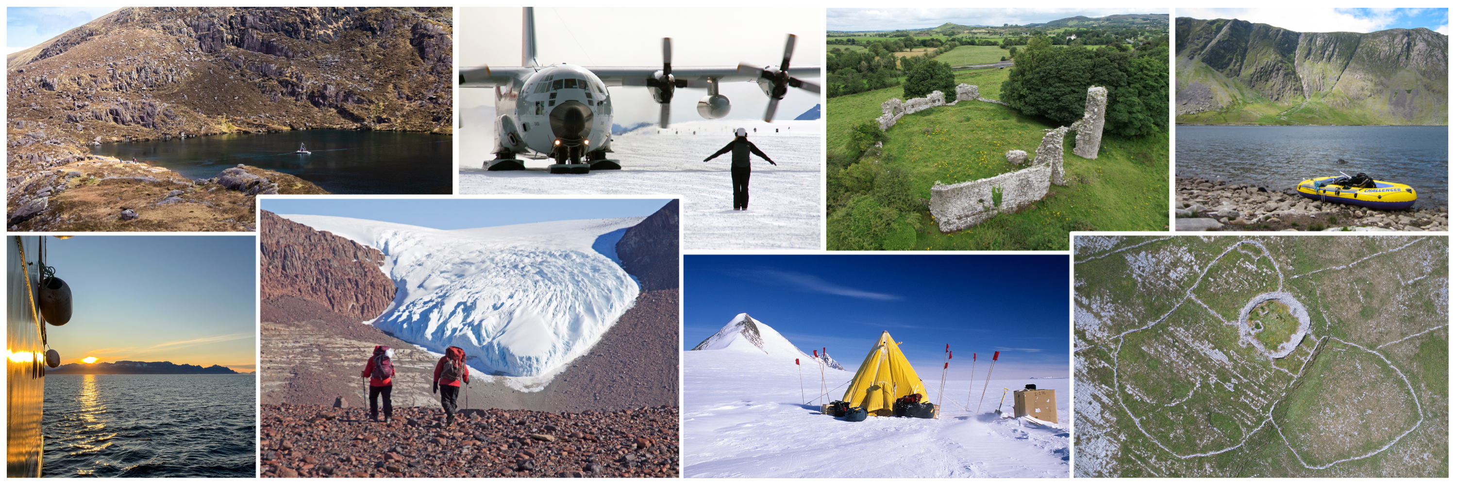
Photo credit: Dr Gordon Bromley, Joe Fenwick, Dr Audrey Morley, Dr Aaron Potito, Ben Ryan and Dr Karen Taylor.