-
Courses

Courses
Choosing a course is one of the most important decisions you'll ever make! View our courses and see what our students and lecturers have to say about the courses you are interested in at the links below.
-
University Life
University Life
Each year more than 4,000 choose University of Galway as their University of choice. Find out what life at University of Galway is all about here.
-
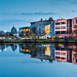
About University of Galway
About University of Galway
Since 1845, University of Galway has been sharing the highest quality teaching and research with Ireland and the world. Find out what makes our University so special – from our distinguished history to the latest news and campus developments.
-
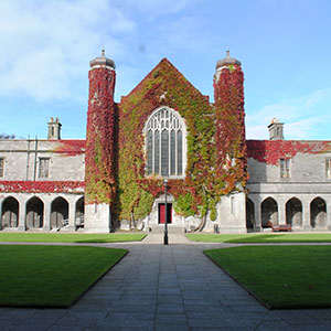
Colleges & Schools
Colleges & Schools
University of Galway has earned international recognition as a research-led university with a commitment to top quality teaching across a range of key areas of expertise.
-
Research & Innovation
Research & Innovation
University of Galway’s vibrant research community take on some of the most pressing challenges of our times.
-
Business & Industry
Guiding Breakthrough Research at University of Galway
We explore and facilitate commercial opportunities for the research community at University of Galway, as well as facilitating industry partnership.
-
Alumni & Friends

Alumni & Friends
There are 128,000 University of Galway alumni worldwide. Stay connected to your alumni community! Join our social networks and update your details online.
-
Community Engagement
Community Engagement
At University of Galway, we believe that the best learning takes place when you apply what you learn in a real world context. That's why many of our courses include work placements or community projects.


October 2011 Coastal Radar Deployed in Galway Bay
Coastal Radar Deployed in Galway Bay
Dr Mike Hartnett from NUI Galway’s Ryan Institute headed-up the deployment of a sophisticated coastal radar system in Galway Bay
Oct
27
2011
Posted: 10:09 IST
Researchers from the Ryan Institute at NUI Galway have just deployed a sophisticated coastal radar system in Galway Bay. The system transmits maps of the surface currents and also provides details of the height and direction of waves from the shoreline directly to the Institute. The cutting edge technology has many potential uses for research and for the local community, and this is the first time it is being used in North Atlantic European waters.
The Modelling and Informatics Group in the Ryan Institute, led by Dr Mike Hartnett, develops models to forecast marine conditions such as tidal currents, storm surges and wave heights. The group are currently carrying out research, in collaboration with IBM Smarter Cities Technology Centre, Dublin, to improve model forecasts using the radar data and meteorological data.
According to Dr Hartnett, “We are using data from the radars to improve model forecasts in ways previously not possible. It is relatively difficult to develop an accurate marine forecast model for Galway Bay, as water movement within the bay is mainly due to wind, while the patterns of incoming tides are complicated due to the flow of water around the Aran Islands. Data from the radar is helping us to overcome some of those challenges.”
The radar system will also benefit the local community. When the research is completed all of the radar maps of surface currents, along with model forecasts will be made available freely online to the public through the Galway Bay Coastal Observing System (GalCOS). This information can then be used by sailors, fishermen and tourists alike. It will also be of use to local authorities and others who discharge effluent into the bay, by helping them to decide on the best time to release effluent and minimize environmental consequences. The research will be of considerable benefit to the search and rescue activities of the Irish Coast Guard.
There are also plans to produce high-resolution maps of Galway Bay on CD, which will be of particular benefit to sailors as reference material and will provide significantly improved knowledge of tidal and wind induced currents.
Dr Hartnett explains how the technology works: “The system consists of two antennae, one located on Mutton Island in inner Galway Bay, and the other located at Spiddal. Every half hour the radars remotely sense the surface of the bay using acoustic techniques. Wireless radio communications are used to enable the system transmit maps of the surface currents in the bay back to NUI Galway. This is high resolution data, providing information on surface currents every 300m. Also, the radars provide wave height and direction data at selected locations within the bay.”
“This sophisticated new sensing infrastructure will produce vast amounts of data requiring continuous analysis and assimilation with other data to improve our ability to understand and forecast conditions in the bay,” says Dr Lisa Amini, Director, Smarter Cities Technology Centre. “This type of predictive modelling is critical to our Smarter Cities agenda, and the findings can be widely applied to protect coastal cities and their environments. IBM Research and Development - Ireland is happy to apply our expertise in real-time streaming processing, statistical modelling, and robust optimisation and control, in collaboration with NUI Galway, to this challenge.”
Previously, the NUI Galway Group have worked in conjunction with the Health and Safety Executive West applying models to assist with managing the retention of the blue flag beach status at Salthill. The new radar system can now contribute significantly to the environmental management and protection of Galway Bay and assisting with compliance of EU Directives, such as the Water Framework Directive. The results from this infrastructure are also being made available to a new research project just commencing in Galway Bay, SmartBay - a collaborative research project including researchers from NUI Galway and other Irish institutes of higher education.
Dr Harnett adds: “In the future it is planned that the radar system will be moved and used to map most of the major bays and estuaries around Ireland. This research will result in the most detailed charts of surface currents every developed for Irish waters. In the longer term results from the system will be used to assess trends of climate change in Irish coastal waters.”
The radar system has been funded by Higher Education Authority under Cycle IV of its Programme for Research in Third Level Institutes.
ENDS